
The San Diego Safari Park was constructed in 1972 and is part of the private, non-profit San Diego Zoo Wildlife Alliance (SDZWA) organization that also includes the San Diego Zoo. The sewer system was constructed in 1972 and has been expanded over the years. The SDZWA wants to document the location of the sewer system, identify pipe diameter, depth, material, location, and connection joints, as well as determine conditions of the pipes and connections within the sewer system. Understanding sewer system pipe locations and conditions will help the SDZWA address blockages and prioritize repair and maintenance projects within the Safari Park sewer system. GIS map products will assist Park staff to efficiently identify, and field locate, cleanouts and sewer lines. The condition assessment will document clean out location and condition; pipeline defects, damage, leaks, obstructions such as roots; and manhole riser, stair, and cover condition.
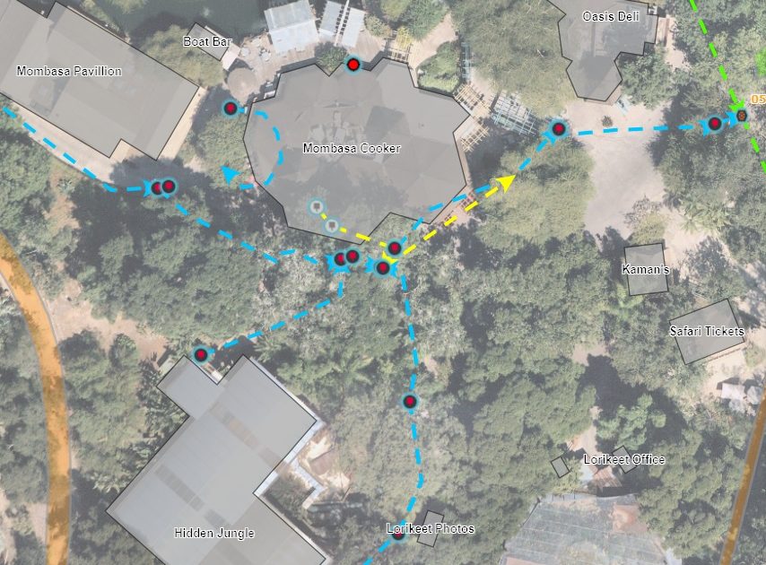
ENGEO developed and continues to update a cross-functional GIS platform for all Safari Park stakeholders. The GIS platform is used for regular project progress updates. The platform could also be used for document archiving, repository for digital imagery, links to video surveys, and a means for real-time improvement plan overlay creation. Data is input on a regular basis by ENGEO staff with the option for future tools to help visualize and understand the data. The GIS platform can continue to be utilized and is readily extendable as an asset management system, for future operations and maintenance, and for planning and maintenance of other park utilities and infrastructure.
ENGEO collaborated with the Park Project Manager to ensure that specific zones were avoided for a given period based on the needs of Park animals. We provided a proposed work schedule for each workday with alternative schedules as needed based on Park animals. In addition, all work was completed before normal Park business hours to not impact the visitor’s experience. ENGEO GIS analysts were able to coordinate directly with Park GIS staff to identify their needs and provide a clear and useful map product with links to each pipeline video survey.